
Trace an Asheville Street Directory Address
A street-by-street search begins with a single, normalized address rather than a broad name search. Record the original spelling, number, direction, unit, and the date tied to it. Use the county tax or map result to find the parcel identifier, then treat that identifier as the handoff between the address and land records. The sequence can identify a current assessment record and a dated title trail. It cannot turn a mailing address, a permit contact, or a historic directory line into proof of present residence.
- Search the address in Buncombe County Tax Lookup or BuncoMap and preserve the PINN, situs address, and source date shown by the selected result.
- Open the matching parcel in BuncoMap, compare the legal and map context, and note deed or plat references when displayed.
- Use the current deed reference to search the Buncombe Register of Deeds index; follow prior instrument references backward one document at a time.
- For a dated civic clue, use the North Carolina voter resources and precinct layers within their legal limits. The public name lookup is not a block search, and public files have protected fields.
- For an earlier address listing, compare a Householders or Street Guide section in an Asheville directory with the alphabetical section, then confirm it with a deed, map, obituary, or other dated source.
Keep a short record of which fact came from which source. The same number may be a postal address, a situs address, a directory address, or part of a historic street pattern.
Search Asheville Street Records in Tax Lookup
Buncombe County identifies Tax Lookup as the entry point for property-tax and assessment research. The live applications support searches by address, owner, or PIN or PINN, although the research capture did not establish every current dynamic label. A selected property card can expose acreage, assessment and sale context, tax district, subdivision or zoning, plus situs and mailing fields. Capture only fields actually displayed on the selected card. A tax mailing destination is not a statement about who is at the property.
| Tax or parcel input | What to save from a result | Careful reading |
|---|---|---|
| Address | Exact query, standardized result, situs address, source date | Address formatting may change in the live system. |
| Owner | Displayed owner label and parcel link | Ownership is a role in an assessment record, not a residency finding. |
| PIN or PINN | Parcel identifier and deed or plat handoff | A parcel split or recombination can change an identifier. |
| Selected property card | Only displayed acreage, values, sale, district, subdivision, zoning, and address fields | Preserve the county disclaimer with map-derived notes. |
Buncombe Land Records also provides property-card, map, research-request, deceased-owner, and property-split routes. Land Records lists 182 College Street and 828-250-4970; Tax Assessment lists 828-250-4920. Both offices post weekday hours of 8:00 a.m. to 5:00 p.m. in the research material. Confirm current counter procedures before a visit.
Note: The research did not verify a stable live exemption field, so no exemption should be treated as a current occupancy finding.
See the Land Records source before requesting a card, map, or report.
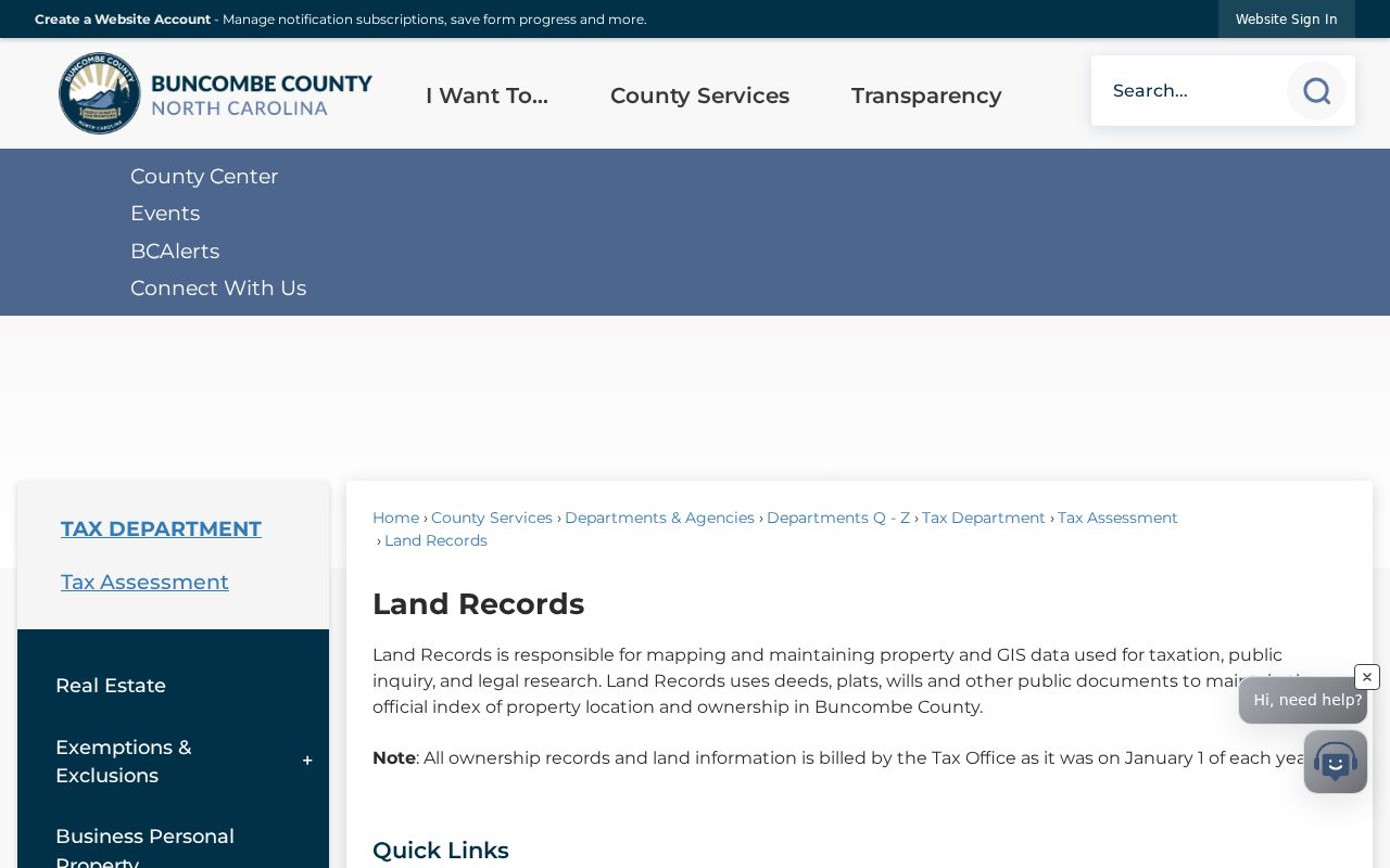
The Land Records image is a reminder that a street directory trail uses the county’s request and map channels as well as its live lookup.
Browse Asheville Streets in BuncoMap
BuncoMap searches by PINN, street name, or owner name and provides a route to deed or plat searching. Select a parcel, read its PINN and visible card fields, then use the deed or plat reference to reach the primary land record. Property and Address layers support an address-based street view; Street Centerline adds road context. ZIP Code, Incorporated Areas, precincts, districts, zoning, and environmental layers add geography, but they do not identify a household.
The map has useful boundaries around its usefulness. County GIS says its data are compiled from deeds, plats, and public records, may contain errors or omissions, and are not survey-grade. A line on a map is therefore a research lead, not a legal boundary. The GIS service also lists a 2,000-record maximum per response for its query service, so an unfiltered export should never be assumed complete.
Open the Buncombe GIS open-data layer list when a map result needs context.
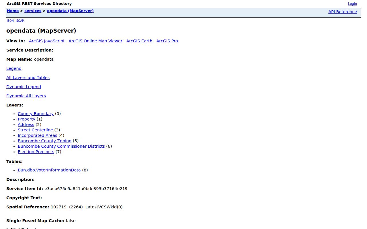
The open-data catalog shows why a street search needs separate parcel, address, road, ZIP, incorporated-area, and precinct layers instead of one combined conclusion.
GIS help is listed at 59 Woodfin Place, Asheville, with 828-250-6860. The county says data and applications may be modified and are refreshed daily around 6:00 a.m. on weekdays.
Follow Asheville Deed Links by Address
The Register of Deeds holds conveyances, deeds of trust, plats, powers of attorney, assumed names, and other recorded instruments. Its collection reaches as early as the 1700s, while the inspected Consolidated Real Property book and page index displayed a 1995 to 2026 range. Those statements describe different things. They do not establish one universal online cutoff for every book or image.
For an Asheville street directory trail, start with the current deed reference and read the instrument type, recording date, book and page, party roles, legal description, consideration or excise information where shown, and prior deed reference. Follow that earlier reference backward. A grantor or grantee is a role in a recorded document, not an occupant label. If a parcel was split or combined, compare the legal description and plat with GIS history instead of relying on a street number alone.
Use the Register of Deeds name index for name, side, name type, index type, date, sort, and autocomplete controls. Older or unindexed material may require the public search room at 205 College Street, open Monday through Friday from 8:00 a.m. to 5:00 p.m., a staff contact, or North Carolina State Archives county-record and microfilm research.
View the official name-index screen before beginning a deed search.
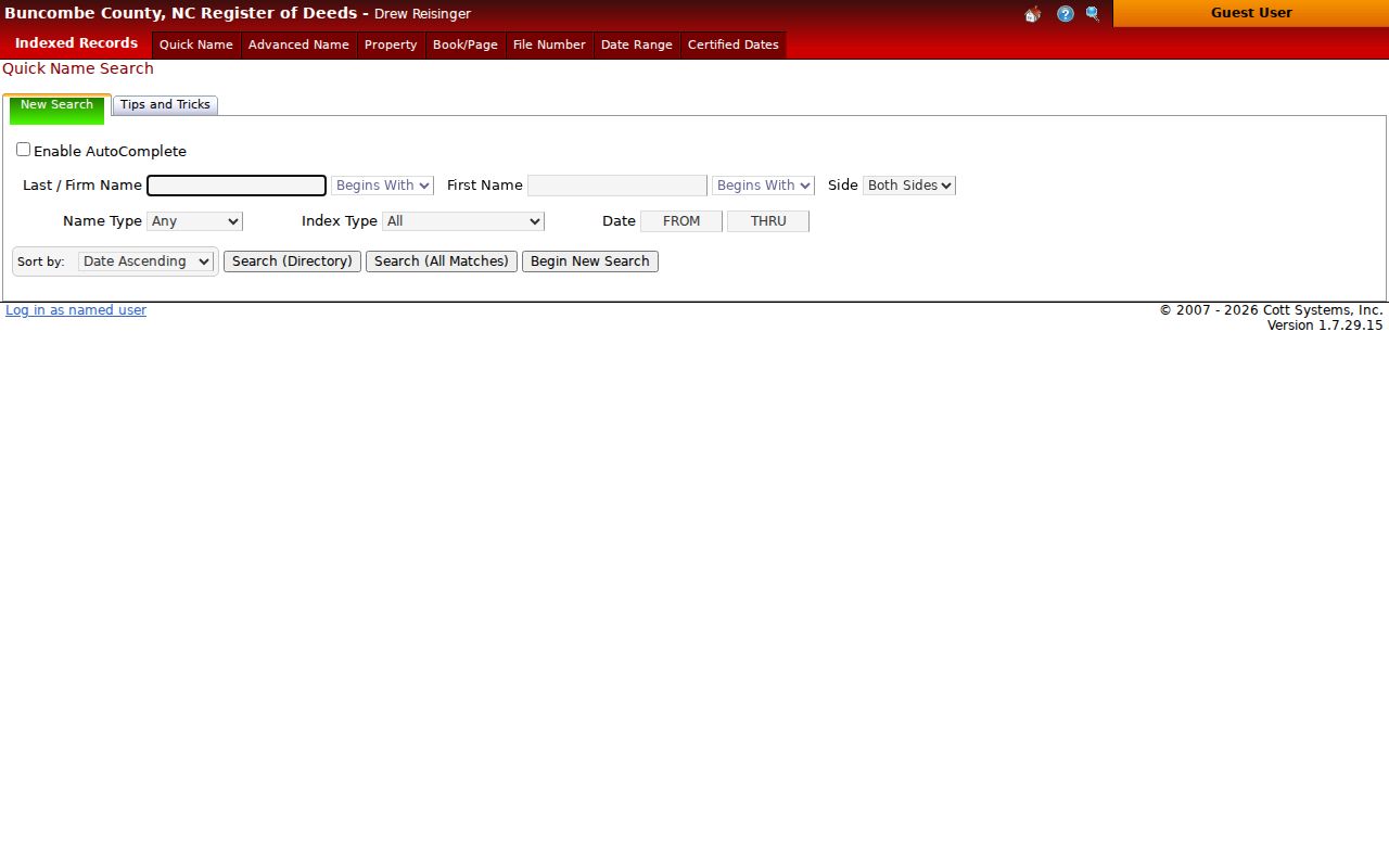
The index controls support a document trail, but the recorded image and the office’s historical access channels remain the place to verify a legal description.
Asheville Street Directory Records Compared
Address-keyed sources answer different questions along the same road. The property and map systems provide a parcel handoff. The deed index identifies recorded transactions. Permit files show dated development information. Voter sources supply limited public registration and precinct context. Directory Street Guide sections can show a historical listing at a number. The Asheville street directory should keep those categories separate rather than merge them into a single person profile.
| Address record | What it can show | How Buncombe or Asheville provides it | Limit |
|---|---|---|---|
| Tax and assessment roll | Owner, PINN, situs, mailing, value, sale, and tax context | Tax Lookup; Assessor or Land Records counter | Mailing information does not establish current residence. |
| GIS parcel viewer | Parcel geometry, deed or plat handoff, layers, and map context | BuncoMap by PINN, street, or owner | Not survey-grade or a legal boundary finding. |
| Recorded documents | Party roles, document type, book and page, legal description | ROD index, search room, image or copy | Online historical coverage varies. |
| City permits and zoning | Permit type, dates, project, address or parcel, applicant or contractor | Citizen Access or City request | Pre-2019 material may remain paper. |
| Voter and directory sources | Public registration context or a dated householder listing | NCSBE or Buncombe Board; Pack, DigitalNC, UNC | Neither proves a present household. |
The North Carolina voter search requires first and last name, with middle initial, birth year, and county as optional fields. It searches names and status, not a street map. Weekly public registration data and precinct layers must be used with the protections for date of birth, identity numbers, and qualifying Address Confidentiality Program information.
Place Asheville Permits in the Street Trail
The City’s permit lookup offers Address or Parcel Information as the search choice. City research says current and completed permit records are searchable. Much material before 2019 may still be paper or not digitized, so a detailed older request belongs with Development Services or the City public-record process. A permit can provide a date, type, project description, inspection or completion clue, but an applicant or contractor is not a household finding.
Development Services is listed at 161 South Charlotte Street. The research lists PAC at 828-259-5846 and PAC@AshevilleNC.gov, Planning at 828-259-5450, and Building Code at 828-259-5967, with posted office hours of 8:30 a.m. to 5:00 p.m. An address, parcel, permit type, and date range make a narrower request. Asheville’s City request page directs requests under North Carolina Public Records Act, Chapter 132, and does not require the City to create a new record set.
Inspect the City permit lookup when an address has a development-record question.
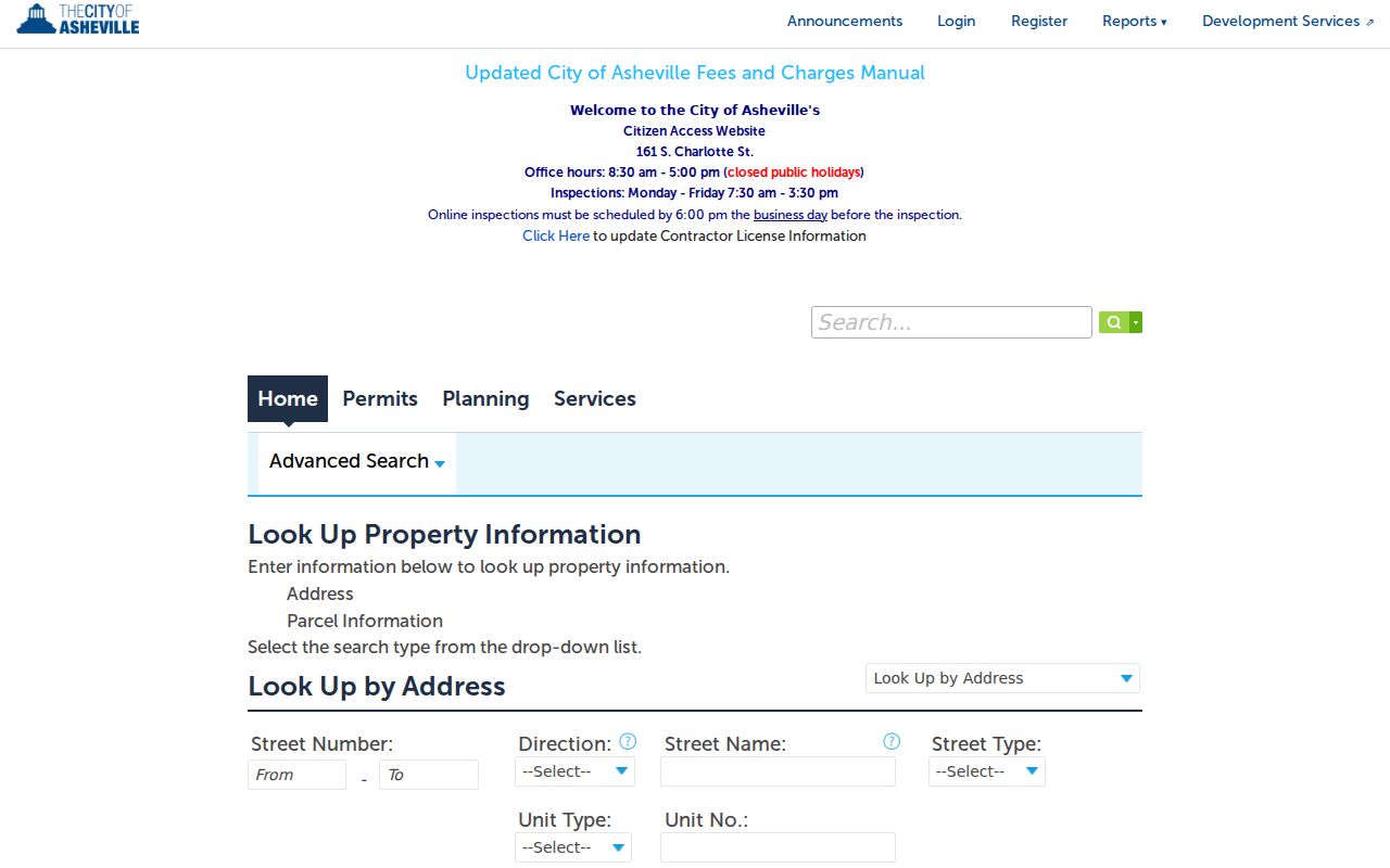
The lookup’s address-or-parcel choice makes the permit record a useful dated layer after the parcel has been identified.
Note: Preserve permit date, role, and project details separately from ownership and address evidence.
Read the Asheville Street Guide Carefully
No separately titled, complete Asheville reverse or criss-cross directory series was verified in the official research. The usable substitute is inside historical volumes: Street Guide, Street and Avenue Guide, Householders, and Numerical Telephone sections. The 1948-49 Hill and Piedmont volume and the 1960 Hill volume contain address-to-listing material. Read those sections beside the alphabetical list, which answers a different question.
- Parcel
- A county land unit represented by a PINN and mapped for assessment and public inquiry. A parcel can change through a split or combination.
- Situs address
- The physical property address recorded for the parcel. It is distinct from a tax mailing destination.
- Plat
- A recorded map that can describe lots, boundaries, or subdivisions. The recorded plat and deed are stronger legal sources than map display alone.
- Street Guide
- A directory section organized by street and number that can preserve a dated householder, business, or telephone listing. It is not proof of title or present occupancy.
Pack Library Special Collections links local directories, its house-history guidance, digital sources, and librarian resources. DigitalNC scans should be checked as images because OCR can misread names and addresses. The first verified 1883-84 directory warned that unnamed streets and homes away from streets made exact placement hard, a limitation that still matters when aligning an old listing to a current parcel.
Map Asheville Street Context by Date
Street names and boundaries are time-sensitive. Asheville’s current code controls official street naming and avoids duplicate or phonetically similar names, while older maps and directories may use a different geography. No official source in the research established one citywide historic renumbering project or year. An old number should not be converted automatically to a current address.
UNC Asheville Special Collections lists boundary changes from 1797 to 1917, annexation material from 1997 to 2004, historic plats and tax maps, and Sanborn resources. Compare the directory year, a Sanborn or other period map, the deed’s legal description, and the current Incorporated Areas layer. Montford, West Asheville, Oakley, Kenilworth, and similar place names can be helpful dated labels, but they are not automatic legal boundary findings.
Street context is most reliable when each map and record carries its own date. A postal ZIP or neighborhood label is supporting geography, not title evidence.
Finish an Asheville Street Directory Search
When an online result is incomplete, use the office that maintains the record. The Register of Deeds search room can help with older land books; Land Records can route a property-card, map, report, or research request; and the City routes detailed or pre-2019 permit material through Development Services and its public-record channel. Pack Library’s North Carolina Room, UNC Asheville Special Collections, DigitalNC, and the State Archives fill the pre-digital gap with directories, maps, microfilm, and county records.
A focused request should identify the custodian, existing record series, address or PINN, date range, document type, and preferred electronic format. Under Chapter 132, request existing records rather than asking an agency to create a list. Ask whether inspection, a redacted copy, or an index search is available and retain the confirmation, response date, fee estimate, and source URL. The county’s 1865 courthouse destruction also means a missing early court or estate record may require surviving deed books, State Archives material, newspapers, or other collection routes.
Keep Asheville Street Directory Limits Clear
An address contains several different facts: parcel situs, tax mailing address, directory address, permit address, voter address, postal address, legal description, and GIS point. They should be stored separately with a source date. A public record may be revised, redacted, protected, or simply out of date. North Carolina’s Address Confidentiality Program can provide a substitute address and mail-forwarding structure for qualifying participants, and its protections must not be used to work backward toward a protected location.
Lawful personal use. Use Asheville street and address records for legitimate personal research, civic context, or family history. Do not use them to stalk, harass, intimidate, or harm anyone, and minimize personal details when sharing a result.
For a question about one person rather than an entire road, move from the address evidence to independent, dated records before drawing a conclusion.